And it even knocked “I’m a Celebrity…Get Me Out of Here!” off the air
The Weather of Wales (and other parts of the United Kingdom)
Just another WeatherTogether site
Yesterday morning the UK Met Office named the low pressure system that had been talked about for a while as a potential snowmaker “Storm Arwen” (a name of Welsh descent meaning “noble maiden” and given to the character of the same name in the “Lord of the Rings” series) and as soon as it was, focus shifted from snow to wind.
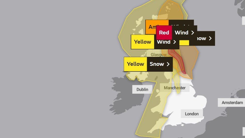
Within hours of the storm being named, yellow warnings for wind, rain and snow (low level impacts) for most of Scotland and the west of the United Kingdom, some of these have been upgraded to amber (There is an increased likelihood of impacts from severe weather, which could potentially disrupt your plans) and for the coasts of eastern Scotland as well as the North East of England a red alert (It is very likely that there will be a risk to life) has been issued turning “Oh, its going to snow” into “batten down the hatches, matey, it be a bad one!”
We Brits seem to have a bit of a love / hate relationship when it comes to the subject of snow. As soon as October comes around, newspapers instantly start wishing for the white stuff with headlines such as “Coldest winter in a century on way” or “-12°C Britain faces snow chaos”. When there is a suggestion of snow in the forecast, the reporting ramps up a gear with headlines such as “Screaming Northerlies to bring winter hell THIS WEEK!”, then when it actually comes along comes the hate side of the relationship.
“SNOW CAUSES BIN COLLECTION BACKLOG” in local newspapers when people suddenly find out that the binmen are also the people who drive the gritting lorries, “GOING SNOWHERE” when people discover that even the slightest amount of snow in the United Kingdom is enough to bring major transport infrastructure to a grinding halt and of course “SNOW CHAOS : And they still claim its global warming” from newspapers who have an extreme right wing agenda that refuses to recognise climate change.
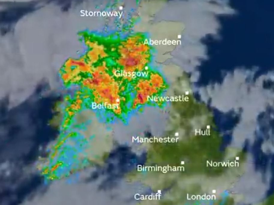
So why do I mention this now? It’s because a lot of models are now talking about a snow event starting at midnight GMT on November 25th as a polar low forms in the North Sea which over the next three days brings a collection of snow showers (dumping snow over the Scottish Highlands, Pennines, Snowdonia and the Brecon Beacons) and as you might expect the media are hyping it up as per usual, therefore you will be pleased to hear that if it does snow, I shall be posting information which is not hyperbole, but actual recordings and photographs.
Oh, and a word of warning, if anyone comes from the Daily Express asking for a comment, run like the plague.

Scotland to take legal action if Typhoon Hagibis forces cancellation
The Rugby World Cup (being hosted by Japan) was awarded to the nation back in 2009. In the time since that decision was made, Japan has seen landfalling hurricanes between September and November on the following occasions:
2009: Melor
2010: Malou, Meranti
2011: Talas, Roke
2012: Jelawat
2013: Toraji, Man-yi, Danas, Wipha
2014: Fung-Wong, Phanfone, Vongfong
2015: Etau
2016: Namtheun, Malou, Malakas, Chaba
2017: Talim, Lan, Saola
2018: Jebi, Trami, Kong-rey
If you are telling me that World Rugby (the organisers) did not have a backup plan for matches being cancelled due to landfalling typhoons then WHAT THE HECK WERE THEY PLAYING AT SINCE 2009???
Members will know that I have long said that just because a hurricane loses it’s tropical status, the National Hurricane Centre shouldn’t forget about it and given the most recent forecast track by the Centre I think this bears saying again

Yes, your eyes are not deceiving you. That is an official National Hurricane Centre forecast track (published at 9.00am UTC this morning) indicating that at 7.00pm BST tomorrow evening, a minimum category one hurricane will make landfall in the Republic of Ireland (the first time since Hurricane Debbie in 1961). With this forecast track, the various weather media in the United Kingdom are going to have to face facts. Hurricanes, especially in the post climate changed world, will make landfall ANYWHERE and that includes the United Kingdom.
(Data Source: Netatmo Temperature Guage kindly supplied by Nathan)
Maximum Maximum
Apr 22.6°C (Apr 23)
May 20.1°C (May 14th)
Jun 26.1°C (June 28th)
Maximum Minimum
Apr 15.3°C (Apr 23)
May 18.2°C (May 31st)
Jun 17.3°C (June 28th)
Minimum Maximum
Apr 7.9°C (Apr 3)
May 12.5°C (May 9th)
Jun 12.9°C (June 11th)
Minimum Minimum
Apr 4.6°C (April 3rd)
May 4.6°C (May 5th)
Jun 8.5°C (June 10th)
In the spirit of open data, I invite people more expert in the analysis of temperatures to use this data in the following context
Average Temperature Aberporth
April: Average Maximum 13°C Average Minimum 4°C
May: Average Maximum 16°C Average Minimum 7°C
June: Average Maximum 18°C Average Minimum 9°C
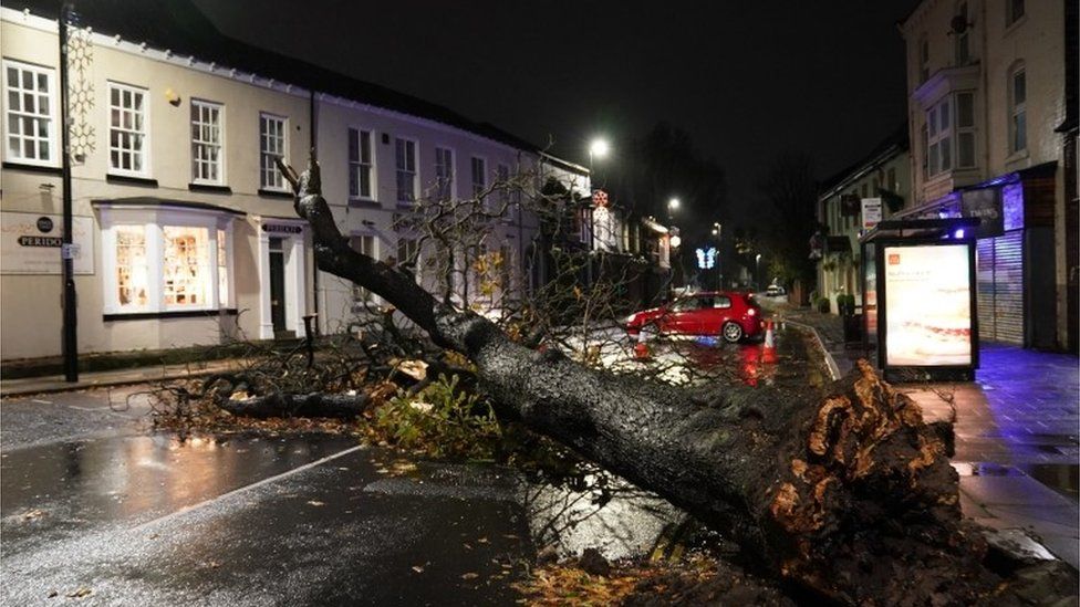
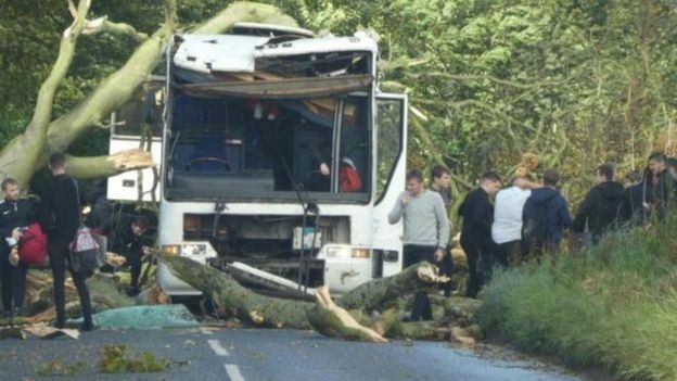
Storm Ali officially ended at 3.00am BST this morning when the last of the winds connected to the storm reduced below gale force in the Shetland Islands leaving a vast amount of damage across Scotland, Northern Ireland and the Republic of Ireland.
In Scotland Michael Matheson MSP (SNP, Falkirk West) who is the Scottish Transport Secretary has chaired a meeting of the Scottish Government’s emergency planning team to review the impact of the storm and to co-ordinate the official response with the committee reporting that they expect everything to be back to rights by this morning.
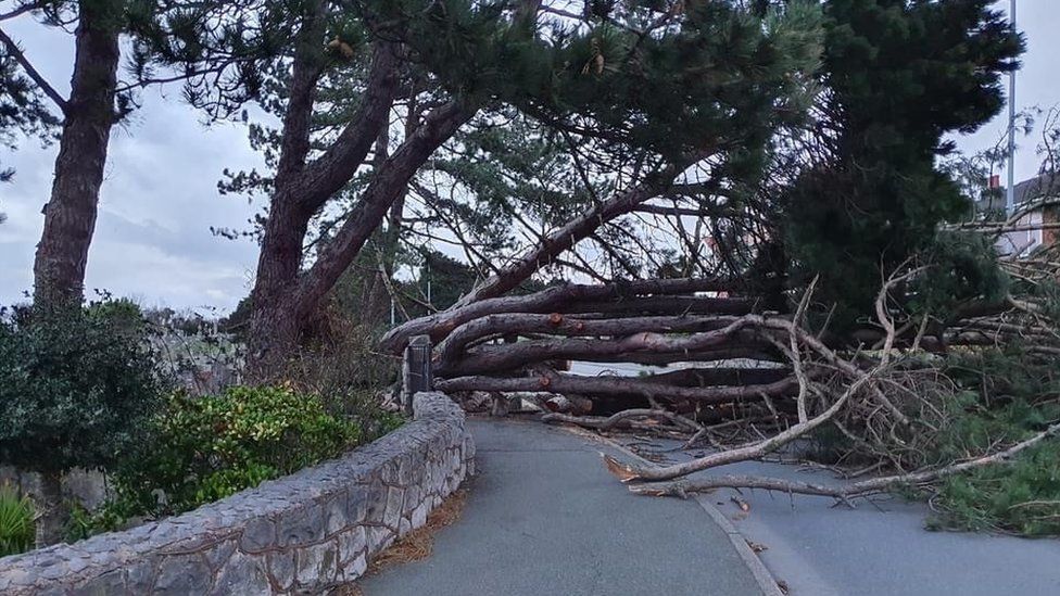
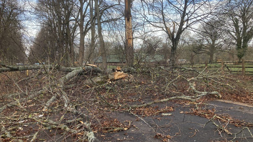
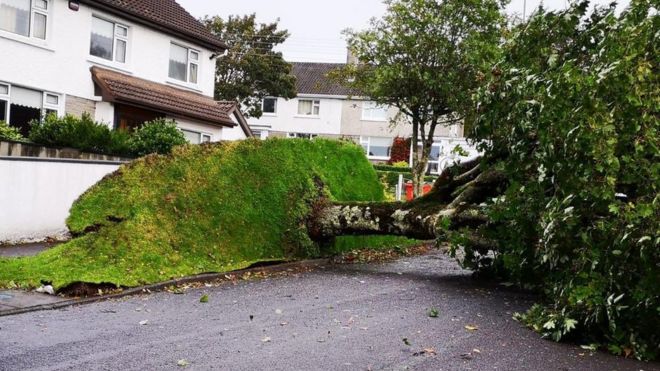
At the height of the storm some 70,000 homes were without power with only 5,000 still without power now (mostly in the Scottish Borders and Dumfries and Galloway council areas), the reason was that a lot of trees were still in full leaf and therefore there was more chance of trees falling (as seen here in Dundee)
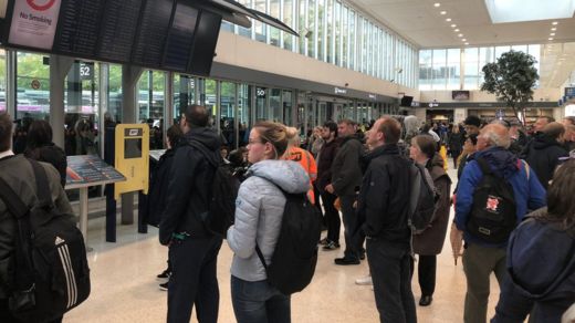
There was also travel disruption on the railway network as well as the bus network that saw queues form at Buchanan Street bus station in Glasgow
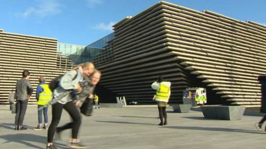
And even the newly opened Victoria and Albert museum in Dundee had to close its doors due to safety concerns
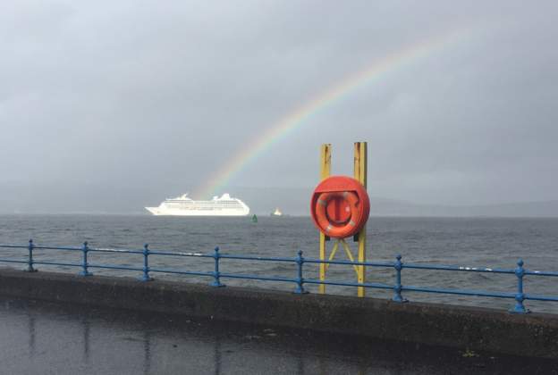
And even a cruise liner, moored in the Clyde in Greenock, was ripped from its lines. Thankfully no one was on board at the time but as this photo shows anyone on board would have seen a marvellous sight
A week ago the UK Met Office and Met Éireann (the Met Office for the Republic of Ireland) announced the names of the winter storms for the 2018/2019 season starting off with Ali, then as in the case of the National Hurricane Centre alternating between male and female thereafter with six Irish names and three Welsh names (gathered from suggestions by the public of both countries).
Today, the first of those storms, Ali, has arrived affecting at the moment County Galway on the west coast of Ireland, but affecting the central belt of Scotland later today. Indeed, even here, we have sustained winds of 10mph, gusting to 19mph.
Month summarised into a single image:

Average daytime maximum temperature: 69°F (+2°F on long term average)
Maximum maximum daytime temperature: 79°F (July 2nd 2018)
Minimum maximum daytime temperature: 64°F (July 30th 2018)
Monthly range: 15°F
Average nighttime minimum temperature: 61°F (+8°F on long term average)
Maximum minimum nighttime temperature: 67°F (July 2nd 2018)
Minimum minimum nighttime temperature: 57°F (July 24th 2018)
Monthly range: 10°F
Monthly rainfall: 1.38” (35mm)
Percentage of average monthly rainfall: 55.12%
Days with no / unmeasureable rain (less than 1mm): 23
Maximum Temperature: 71°F
Minimum Temperature: 65°F
Temperature at 0800 BST (July 11th): 66°F
Rainfall: 0.009 inches (0.25 mm)
Wind Speed: Calm
In order to clarify about rainfall, the rain guage I have has markings in both mm and inches. The lowest marking is 1mm = 0.04 inches, however by using the scale above, I simply use that same scale backwards and then publish the information in inches for international comparsion by taking the mm figure and dividing by 25.4. However on July 2nd I miscalculated and what I published as 0.002 inches (0.05mm) should actually have been 0.02 inches (0.5mm)


