Storm Caroline may have been just a northern Scotland event

but, my word, is the rest of the UK feeling the after effects of it.

At its deepest, Storm Caroline was pummelling the Northern Isles of Scotland with helicopters, normally used in coastguard operations being roped in to help with the restoration of power

However, Caroline has a nasty sting in the tail in the form of becoming a polar low and opening the floodgates to the most arctic air that Britain has seen for at least four years giving parts of Britain their first significant snowfall since 2010 such as the Yorkshire Moors and that’s not the end of it. On Saturday evening another low pressure will approach the UK from the south west and cause the biggest dump of snow for seven years (making what fell today look like a mere pittance)

This week’s weather in the United Kingdom is going to be…

and that is putting it mildly. At the moment everything is as you would expect for an early December day, there’s a bit of cloud everywhere but generally speaking it’s a non descript sort of day allowing everyone to carry on and generally ignore the weather with the same the true on Tuesday, however on Wednesday we come to the “CRAZY” element of the week. At 6.00am on Wednesday morning, an Atlantic depression approaches Ireland and (as is the case with depressions) a front starts to cross the country (producing up to three inches of rain in some parts of the country)

However, it is what happens when that depression crosses the country that the “OUTRAGEOUS” element comes into play, for when it reaches the east coast, it turns into a polar low (and one of the biggest polar lows I have seen for many a year) and what happens when you have a polar low in winter. It snows or in this case, it blizzards

And what is the result of this? Well, in some parts of Scotland you will up end with 25 cm (10 inches) of lying snow, at the Great Orme in Conwy about 6 cm (2½ inches), and even as far inland as Stratford upon Avon in Warwickshire, you could expect to see at least half an inch of snow on the ground (producing scenes like this across the home town of England’s bard)

Local Weather Systems

From time to time, the climate of an area generates events that are so unique to that area that they are named after the area. For instance, low pressure systems that form over western Canada and make a rapid beeline for the east coast of the United States are called Alberta Clippers and in the same vein winds that blow onshore in California causing a massive heat up (and as a result pose a threat to forest fire management) are known as the Santa Ana Winds. Well, here in the UK and specifically in Wales we have our own locally named weather event.

If the winds blow from the north (as they have done for over a week now) the way that the United Kingdom is aligned means that those winds pass between mainland Scotland and the Western Isles and then get funnelled by the gap between the coast of Antrim and Dumfries and Galloway. As they continue their way down (picking up moisture from the Irish Sea on the way) they meet the Isle of Man are get split into two directions. One direction is through the Cheshire Gap or as it is more commonly known the Cheshire Plains (a relatively flat expanse of lowland almost entirely within the county of Cheshire in North West England. It extends from the Mersey Valley in the north to the Shropshire Hills in the south, bounded by the hills of North Wales to the west and the foothills of the Pennines to the north-east) where if the winds are strong enough allow that moisture to drift towards Birmingham and produce snow over the Staffordshire moorlands. The other section continues southwards and reaches the western coast of Wales and the counties of Cornwall and Devon producing what is known as a “Pembrokeshire dangler” and for the last couple of days that is precisely what we have been having (as seen by these radar images from the Met Office)

Pembrokeshire Dangler

And given the fact that it is going to remain cold for the next several days, it is not without the realms of possibility that the dangler could give Ceredigion its first snowfall since 2013

“Oh, the weather outside is frightful…”

is the opening line to the song “Let it Snow” (written incidentally during a Californian heatwave in 1945) and made famous by performances by Ella Fitzgerald in 1960 and Rod Stewart in 2012, however it is also what the population of Lancashire, North Yorkshire, North Wales and parts of Southern Scotland were also exclaiming yesterday afternoon when a total of 43 cm (around one and three quarter inches) of rain fell over Lancashire in the twenty four hours finishing at 0600 GMT on November 23rd 2017. And what did this rainfall do? Well…

It flooded Carnforth Railway Station in Lancashire

Caused the River Conger to burst it banks

Flooded the car park of Ynys Môn (Anglesey) council in Llangefni

and even managed to cause the closure of multiple roads in the counties affected and, if you can believe it, we are not out of the woods yet. Starting tonight, the winds that have been coming from the southwest and bringing all this rain, swing round to the north and winter makes it’s first aggressive move into the United Kingdom as seen in this forecast issued by the UK Met Office this afternoon (November 23rd 2017)

An introduction to the weather of Wales

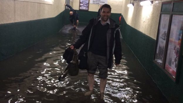
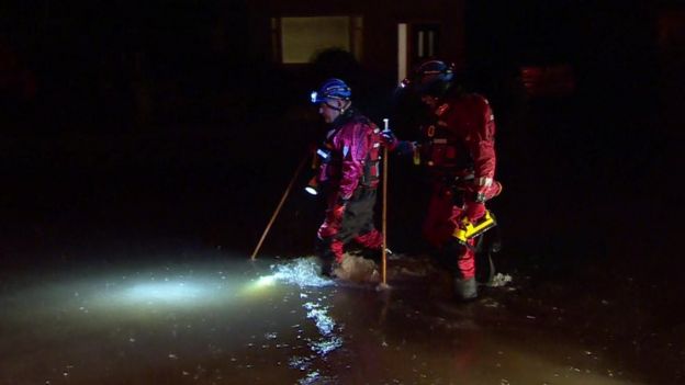
It has often been said that Wales’s climate can be described in just three words “Rain, Rain, Rain” and whilst this is true in a large part of the country, it is a generalisation that is slightly wide of the mark (in the same regard that it always rains in Manchester)

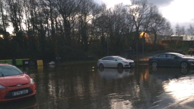
As a general rule of thumb, Wales has a pretty equitable climate with the coasts being kept warm in the winter and cool in the summer, and the reverse true for the mountains and heartlands. For instance where I live on the coast of the county of Ceredigion, we get an average annual temperature of 16°C (61°F) which covers a multitude of sins, for instance the recent high has been 21°C (70°F) recorded in July 2013 and the recent low has been 1°C (33°F) during that bitter cold spell in December 2010. Rainfall, as I alluded to at the start, is moderately high (thanks to the fact we live on the coast) but a general rule of thumb is that we average 100mm (4 inches of rain) a month, but like most places that can and does vary from a recent high of 515mm (20½ inches of rain) in November 2009 to a recent low of 26.2 mm (1 inch) in September 2014.

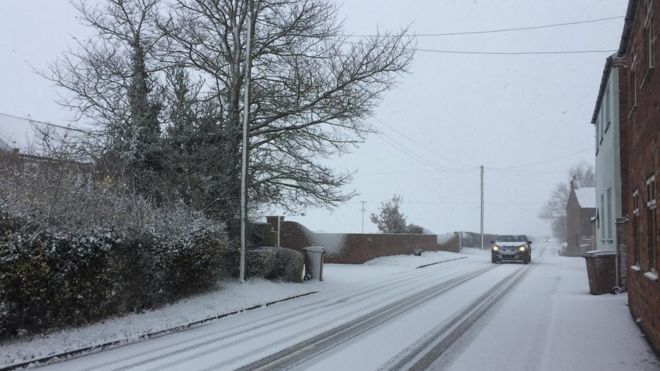
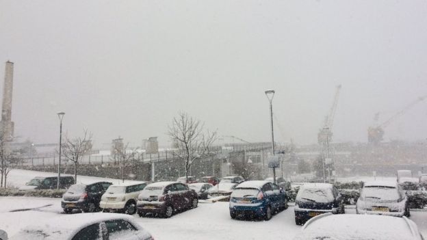
Due to our coastal position snow is a rarity (more’s the pity I say), in fact it is so rare that during the last seven winters (2009 – 2017) we have only had 52 days where snow fell (that’s 14% of all the days) but just as with rain we have seen some big variations ranging from flurries placing less than a centimetre of snow on the ground, to right monsters of a winter with winter 2010-2011 being the mother of all winters, dumping a combined 16½ cm (6½ inches) of snow on the ground and leading to scenes like this

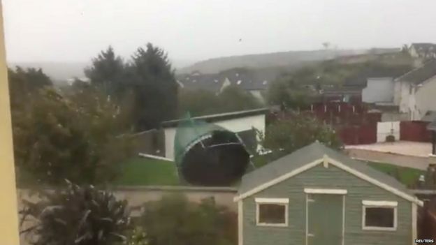
The other problem with the coast is that there is nothing stopping us getting the full force of the wind (save for Ireland and that’s not even visible on the horizon from here) so it should come as no surprise to hear that on average our winds gust up to 20mph, but when we get a storm boy do we know about it as many is the time that our nearest Met Office station at Aberport gets mentioned on the “Strongest Gusts” leaderboard

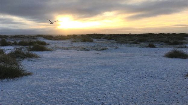
And when we get these storms, the pressure drops like a stone, whether it’s the winter storm of February 2014 that saw the pressure plunge to 993mb or November 2009 (997mb) but generally speaking we average about 1,010mb, so when we get high pressure, boy do we know about it as demonstrated in February 2012 when we averaged 1,030mb and so therefore as we are fairly average, we get a fairly average distribution of clouds but when they do break as they did in June 2015 out comes the sunscreen (as the average UV index was 6 on an 11 point scale), but those clouds can be a right annoyance, take December 2015 for instance, during the whole month the sun only shone for a day (25 hours out of 248 hours) but this does not detract from the fact that most days here are clear and you can see up to five miles in any direction, so overall I would say that this part of Wales is a very nice place to visit (and in these post Brexit days, we need all the visitors we can get!)

So, Ophelia made landfall and what happened?

Well, it all depended on what part of the United Kingdom you were in when it did. If you lived in the Republic of Ireland it was a simple case of “Batten down the hatches and stay indoors”, advice ignored by the folks at RTE (Radio Telefis Eireaan) who are the national broadcasters who endured the worst of it but were able to report on things such as a trampoline being blown away in County Cork

County Cork

The postal service coming to a complete standstill

Postboxes in Dublin

and thanks to social media a recording of a gust of wind measuring 119 mph at Fastnet Lighthouse all which prompted the Prime Minister (or Taoiseach as he is called in the Irish Republic) saying “When we say stay at home, we mean it!

And what about the rest of the UK you may ask? Well, the rest of the country was thinking “Well, this doesn’t look too bad!” when they woke up but soon a new hashtag was appearing on social media #redsun as all over the country photographs started to appear showing the exact same time

Central London (The Shard)

Bristol

Bromsgrove, Worcestershire

and even here

So what was causing this? Was this a sign that Ophelia was bigger than expected? Well, yes and no. Yes, Ophelia was much bigger with air being brought up from Spain and North Africa and that’s the clue. In amongst all that of that warmth was, by my reckoning, about two tons of Saharan sand and smoke from the wildfires in Spain and Portgual, which as you all knows shifts the spectrum into the red end and thus produces a sunset in the middle of the day. I was lucky enough to actually record the transition from the sand section of the storm to the not sandy section and will put that online if members would like me to?

We have ourselves a landfalling hurricane

National Hurricane Centre Forecast for Hurricane Ophelia

So it seems only fair to have a look at the history of land falling storms in the United Kingdom and the Republic of Ireland and it turns out there is quite the history. Using reconstruction the first land falling hurricane was in 1680 which became extra tropical and affected both Wales and Southern England, then some two hundred years later another one crossed the UK causing rough seas in the English Channel, followed by three in three years (and the last two happening within two months of each other!)

In the 20th century, the UK has had land falling hurricanes in 1922, 1961, 1966, 1973, 1978, 1986, 1993, 1996 and 1998 (including famous hurricanes such as Debbie, Charley and Lili) and since the turn of the millennium we’ve had Issac in 2000, Katia in 2011 and now Ophelia in 2017.

So what’s likely to happen? Well, the latest estimates are calling for a landfall at around 1.00pm BST on Monday in the extreme south west of Ireland, tracking across the island and reaching Northern Ireland by 5.00pm BST before travelling across the sea to Scotland making a second landfall in Argyll and Bute around midnight on Tuesday morning, and then a third landfall over the Orkney Islands and a fourth landfall over the Shetland Islands during the course of Tuesday.

The National Hurricane Centre has just set the biggest cat in amongst the pigeons possible

In January 1839, the “Night of the Big Wind” which the Dublin Daily Press reported “We dare not call this hurricane a phenomenon, however rare or unprecedented. But it will, nevertheless, become a study to our meteorologists” is such a cultural feature of the history of Ireland as the biggest storm ever to make landfall in what is now the Irish Republic with estimates stating that it could have been as big as a cat 3 storm. In 2011, the remains of Hurricane Katia made landfall in Ireland leading to scenes like this

[youtube https://www.youtube.com/watch?v=pYg5Fh3Ifhk?ecver=1&w=749&h=422]

And just as in the UK, the remains of Hurricane Charley led to the same mass flooding, however if what the NHC and NOAA have just published holds true on Monday, then Ireland is about to have it’s second “Night of the Big Wind” and it’s second land falling hurricane

NOAA Forecast published October 14th 2017

Therefore, as your reporter from this neck of the woods (who although assured by the BBC is not a hurricane) will do everything I can to a) report on the effects of Ophelia on the UK and b) raise awareness that, if proof were really needed now, the climate has CHANGED (past tense)